Adventist Youth Honors Answer Book/Recreation/Orienteering
1. Explain what a topographic map is, what you expect to find on it, and three uses for it.
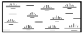
Topographic maps are also commonly called contour maps or "topo maps." Topographic maps conventionally show topography, or land contours, by means of contour lines. Contour lines are curves that connect contiguous points of the same altitude. In other words, every point on the marked line of 100 m elevation is 100 m above mean sea level.
Other than showing elevation via the contours, you can also expect a topographic map to show any important landmarks, such as rivers, lakes, and roads. They will often also show railroad tracks and major power lines (and their towers). Power lines are especially handy because the towers are visible from great distances and each represents a point on a map (whereas a road or river would represent a curved line). These attributes make them ideal for pinpointing position.
Topographic maps have many uses, letting a competent user determine any of the following:
- Where he is.
- How to get where he wants to go.
- What the terrain is like in a given area (steepness, for example).
- Where a river comes from and goes to.
- The route a hiking trail follows.
- The location of campsites.
- The distance between to points.
- Elevation of a mountaintop.
- Latitude and longitude of any point on the map.
- What areas may be susceptible to avalanches or flooding.
2. Identify at least 20 signs and symbols used on topographic maps.
These symbols are used by the U.S. National Park Service:

Airport

Boat launch

Campground

Canoe access

Drinking water

First aid

Fishing

Food service

Four-wheel drive access

Gas station

Hospital

Information

Litter receptacle

Lodging

Parking area

Picnic area

Ranger station

Recycling

Restrooms

RV campground

Self-guiding trail

Shelter

Store

Telephone

Trailhead

Bridge

Hiking trail
Marsh

Parking area
Rapids

Spring

Unpaved road


3. Give the nomenclature of an orienteering compass.

The lensatic compass consists of three major parts: the cover, the base, and the lens.
- a. Cover
- The compass cover protects the floating dial. It contains the sighting wire (front sight) and two luminous sighting slots or dots used for night navigation.
- b. Base
- The body of the compass contains the following movable parts:
- The floating dial is mounted on a pivot so it can rotate freely when the compass is held level. Printed on the dial in luminous figures are an arrow and the letters E and W. The arrow always points to magnetic north and the letters fall at east (E) 90° and west (W) 270° on the dial. There are two scales; the outer scale denotes mils and the inner scale (normally in red) denotes degrees.
- Encasing the floating dial is a glass containing a fixed black index line.
- The bezel ring is a ratchet device that clicks when turned (on some compasses). It contains 120 clicks when rotated fully; each click is equal to 3°. A short luminous line that is used in conjunction with the north-seeking arrow during navigation is contained in the glass face of the bezel ring.
- The thumb loop is attached to the base of the compass.
- c. Lens
- The lens is used to read the dial, and it contains the rear-sight slot used in conjunction with the front for sighting on objects. The rear sight also serves as a lock and clamps the dial when closed for its protection. The rear sight must be opened more than 45° to allow the dial to float freely.
4. Know the meaning of the following terms:
- a. Elevation
- The height of a point relative to sea level.
- b. Contour interval
- The elevation change between adjacent contour lines on a topographic map. If you travel from one contour line to another, your change in elevation will equal the contour interval.
- c. Magnetic North
- Magnetic North is the direction a compass will point, which is towards the North Magnetic Pole. The North Magnetic Pole is not the same place as the Geographic North Pole. The North Magnetic Pole is the point on the Earth's surface where the Earth's magnetic field points directly downwards. This pole is constantly wandering; its estimated 2005 position was 82.7° N 114.4° W.
- d. Declination
- The angular difference between magnetic north and true north (defined in reference to the Geographic North Pole), at any particular location on the Earth's surface, is called the magnetic declination. In other words, it's how far off a compass is from True North, or the correction that must be applied to a compass reading.
- e. Scale
- An important property of a map is the scale. It can be indicated by a scale bar and/or a ratio 1:n. This enables the map user to measure a distance on the map and determine the distance on the ground. These days maps are usually produced under the metric system which makes it easy to perform this task. Maps are usually produced at standard scale factors of (say) 1:10,000 or 1:50,000 or 1:100,000 and all you need to do is take a measurement on the map (in mm) and multiply that figure by the scale factor to determine the distance on the ground. However, maps from some countries may use imperial units, especially older maps. These maps displayed scale ratios but often they were of the form 60 chains (a chain is 22 yards, or 66 feet) to 1 inch or 2 miles to 1 inch, etc.
- f. Measuring
- The act of determining distance on a map and translating it to distance on the ground. In order to do this translation, you must know the map's scale (see above). Measuring can be done with a ruler or with calipers.
- g. Back-azimuth
- See under azimuth below.
- h. True North
- True North is the direction from any point on the Earth's surface to the Geographic North Pole.
- i. Azimuth
- The azimuth is a compass bearing expressed in degrees. There are 360° in a circle, and North is, by convention, 0° (or 360°). East is 90°, South is 180°, and West is 270°. While azimuth expresses the compass bearing in the direction of interest, the Back Azimuth expresses the compass bearing in exactly the opposite direction. In other words, azimuth is the direction to which you are going, and back azimuth is the direction from which you are coming. The back azimuth can be calculated by adding or subtracting 180° from the azimuth. Add if the azimuth is less than 180°, otherwise subtract.
- j. Distance
- Distance is the measure of length, or how far apart two points are away from each other.
5. Demonstrate how to shoot a magnetic azimuth.
The techniques employed to find the magnetic azimuth when using the lensatic compass are as follows:
Using the Centerhold Technique

First, open the compass to its fullest so that the cover forms a straightedge with the base. Move the lens (rear sight) to the rearmost position, allowing the dial to float freely. Next, place your thumb through the thumb loop, form a steady base with your third and fourth fingers, and extend your index finger along the side of the compass. Place the thumb of the other hand between the lens (rear sight) and the bezel ring; extend the index finger along the remaining side of the compass, and the remaining fingers around the fingers of the other hand. Pull your elbows firmly into your sides; this will place the compass between your chin and your belt. To measure an azimuth, simply turn your entire body toward the object, pointing the compass cover directly at the object. Once you are pointing at the object, look down and read the azimuth from beneath the fixed black index line. This preferred method offers the following advantages over the sighting technique:
- It is faster and easier to use.
- It can be used under all conditions of visibility.
- It can be used when navigating over any type of terrain.
- It can be used without putting down other gear; however, any other gear must be slung back out of the way.
- It can be used without removing eyeglasses.
Using the Compass-to-Cheek Technique

The compass-to-cheek technique is used almost exclusively for sighting, and it is the best technique for this purpose.
Fold the cover of the compass containing the sighting wire to a vertical position; then fold the rear sight slightly forward. Look through the rear-sight slot and align the front-sight hairline with the desired object in the distance. Then glance down at the dial through the eye lens to read the azimuth.
6. Demonstrate how to march on a magnetic azimuth.

Although different models of the lensatic compass vary somewhat in the details of their use, the principles are the same.
- Hold the compass level in the palm of the hand.
- Rotate it until the desired azimuth falls under the fixed black index line (for example, 320°), maintaining the azimuth as prescribed.
- Turn the bezel ring until the luminous line is aligned with the north-seeking arrow. Once the alignment is obtained, the compass is preset.
- To follow an azimuth, assume the centerhold technique and turn your body until the north-seeking arrow is aligned with the luminous line. Then proceed forward in the direction of the front cover's sighting wire, which is aligned with the fixed black index line that contains the desired azimuth.
7. Know two methods to correct for declination and when correction is necessary.
- Set it and don’t worry about the declination unless you get a location with a different declination.
- You can add or subtract the declination from the degrees shown on 360 scale of your compass.
- When is correction necessary?
- Correction is necessary any place in the world that is not near the 0 line on a map. The 0 line is the line of longitude on which magnetic north lies.
8. Be able to orient yourself and a map by inspection and by compass.
9. Explain resection and its use.
Resection is a method of using a compass and a map to determine your current position. The first step is to find a feature of the landscape that you can also identify on the map. This could be a mountain peak, an intersection, a bridge, or even a utility pole (some topographic maps mark where high-voltage lines are, as well as the position of the poles that hold them up). The closer these two landmarks are to 90° offset from one another, the more accurate the resection will be. For instance, if the first landmark is at 115°, choose the second one as close to either 205° (115°+90°) or 25° (115°-90°) as you can. This is not a hard and fast rule, and the prominence of the landmark may well be more important than the 90° offset. Once you have shot an azimuth to the first landmark, calculate the back azimuth, and plot a line on your map from the landmark towards (and past) your current position (which should be somewhere on that line). Be sure to correct for declination when plotting this line. Then shoot the azimuth of the second landmark, and plot it's back azimuth on the map as well, again correcting for declination. If your readings are accurate and your plotting was done carefully, your current position should be very close to where these two lines intersect.
10. Prove your ability in the use of a map and/or a compass by following a one-mile (1.6 km) cross-country course with at least five given readings or control points.
Adventist Youth Honors Answer Book/Compass course
