File:Magneticdeclination.jpg
From Pathfinder Wiki
Size of this preview: 624 × 600 pixels. Other resolutions: 250 × 240 pixels | 768 × 738 pixels.
Original file (768 × 738 pixels, file size: 86 KB, MIME type: image/jpeg)


Summary
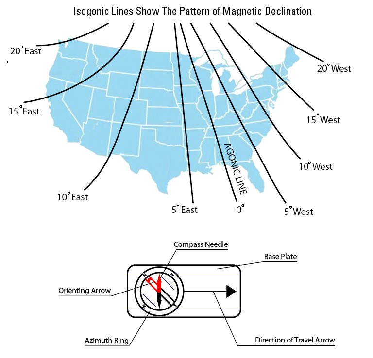
| Description | Diagram showing the pattern of magnetic declination in the United States. |
| Date | |
| Source | http://education.usgs.gov/common/lessons/how_to_use_a_compass_with_a_usgs_topographic_map.html[dead link] |
| Author |
Licensing
This image is in the public domain in the United States because it only contains materials that originally came from the United States Geological Survey, an agency of the United States Department of the Interior. For more information, see the official USGS copyright policy.
|
File history
Click on a date/time to view the file as it appeared at that time.
| Date/Time | Thumbnail | Dimensions | User | Comment | |
|---|---|---|---|---|---|
| current | 01:00, 12 October 2007 | | 768 × 738 (86 KB) | Jomegat | {{Information |Description = Diagram showing the pattern of magnetic declination in the United States. |Source = http://education.usgs.gov/common/lessons/how_to_use_a_compass_with_a_usgs_topographic_map.html }} Category:Navigational aids [[Category: |
