File:USDA Hardiness zone map.jpg
From Pathfinder Wiki
Size of this preview: 601 × 599 pixels. Other resolutions: 241 × 240 pixels | 4,014 × 4,002 pixels.
Original file (4,014 × 4,002 pixels, file size: 5.92 MB, MIME type: image/jpeg)
Summary
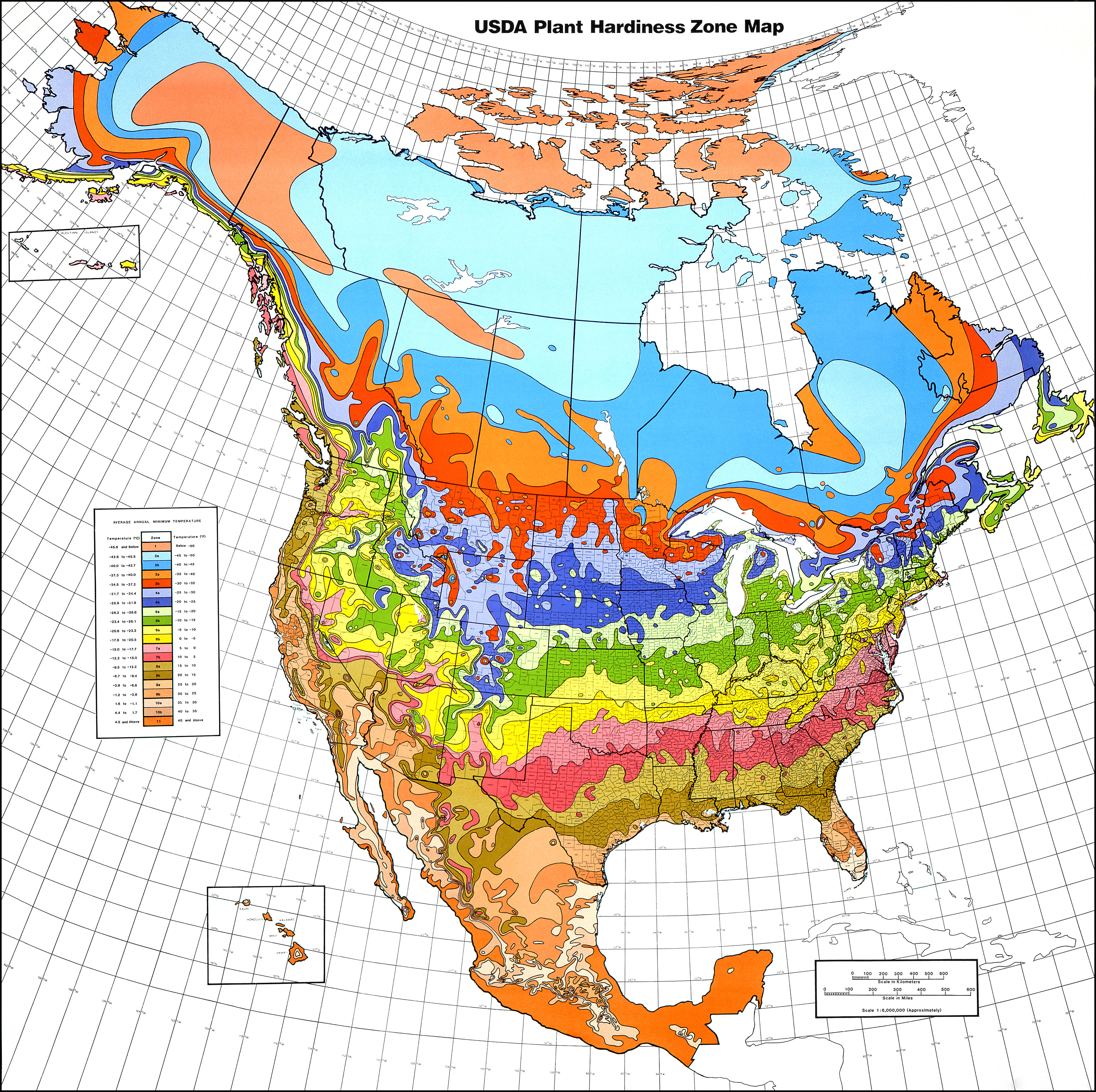
| Description |
English: USDA Hardiness Zones in North America.
Albers equal area projection, standard parallels of 29.5°N and 45.5°N, scale 1 : 6,000,000 (approx.)
118 × 116 cm (46.4 × 45.6 in) (folded: 30 × 21 cm (11.8 × 8.2 in)) |
| Date | 1990, copied 2006-12-31 |
| Source | USDA plant hardiness zone map 1990 (USDA Miscellaneous Publication No. 1475) ISBN: 0160187478, USDA website |
| Author |
Henry M. Cathey while Director, U.S. National Arboretum, Agricultural Research Service, U.S. Department of Agriculture, Washington, DC 20002
|
| Permission (Reusing this file) |
Public Domain |
| Other versions | File:USDAplanthardiness.jpg (with a bit of frame) |
Licensing
This image or file is a work of a United States Department of Agriculture employee, taken or made as part of that person's official duties. As a work of the U.S. federal government, the image is in the public domain.
|
 |
File history
Click on a date/time to view the file as it appeared at that time.
| Date/Time | Thumbnail | Dimensions | User | Comment | |
|---|---|---|---|---|---|
| current | 00:21, 22 January 2013 | | 4,014 × 4,002 (5.92 MB) | Mapmarks | printable size, ca 4000 × 4000 px download from http://planthardiness.ars.usda.gov/PHZMWeb/Images/northamerica.jpg |
File usage
The following 7 pages use this file:
- AY Honor Gardening Answer Key used by General Conference
- AY Honors/Gardening/Answer Key
- AY Honor Gardening Answer Key used by North American Division
- AY Honors/Gardening/Answer Key 2
- Translations:AY Honors/Gardening/Answer Key/20/en
- Translations:AY Honors/Gardening/Answer Key 2/20/en
- Translations:Adventist Youth Honors Answer Book/Outdoor Industries/Gardening/20/en
