AY Honor Glaciers Answer Key
1
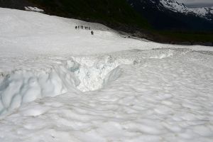
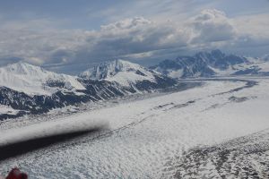
A glacier is a large body of ice and snow that moves under its own weight. Glaciers may form in mountains (alpine glaciers) or across broad areas (continental glaciers) through repeated seasonal snowfall that does not melt. Overtime, the snow is compacted to firn and then to ice, squeezing out air bubbles and becoming a solid mass. The weight of a glacier pushes it across the ground or downslope. Alpine glaciers are often referred to as "rivers of ice," an apt description of these very slow-moving solid water bodies.
The study of glaciers, called glaciology, is an interesting science that brings together elements of geology, hydrology, chemistry, physics, climate and paleo-climate studies, among other fields. Studying glaciers provides insights into geological landforms and how they were made, allows study of changing climate over time both through the advance and retreat of glaciers and through studying the layers of compacted ice by drilling ice cores. Chemical analysis of these cores can show changes in relative atmospheric carbon dioxide, for example, or even capture records of past volcanic activity or plant spores. The rate of glacial retreat offers ways to consider and measure the changing climate. At times, glaciers may reveal ancient artifacts or even frozen mummies that offer anthropological and archeological details of past usage of places, lifestyles, and suggestions of climate.
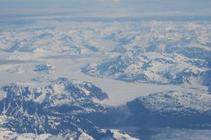
Glaciologists may work in the field, mapping and measuring glaciers by using satellites and drones, tracking advance and retreat by placing lines of poles on active glaciers, or studying past climate and atmosphere through drilling ice cores. Continental glaciers in Antarctica and Greenland may be studies through permanent or seasonal scientific research stations, allowing continued access to the glaciers, where annual precipitation can be tracked, along with any changes in the glacier's movement.
2
2a
2b
Firn is a term for snow that has been compressed enough to eliminate air pockets. If it is compressed further, it will become glacial ice.
2c
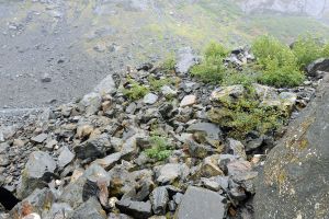
Glacial drift is the term for sediment and debris moved or deposited by a glacier, whether directly through physical erosion and movement, or indirectly, as in debris moved further by water from a melting glacier.
2d
A glacial erratic is a rock or boulder transported by a glacier and left behind when the glacier retreats.
2e
2f
An icefall is the equivalent of a glacial "waterfall," and occurs where a glacier moves over a steep gradient, fracturing the surface of the glacier.
2g
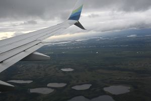
A kettle lake forms when glacial ice in an outwash plain melts in a depression.
2h
Névé refers to the part of a glacier that is permanently covered with snow.
2i
Paternoster lakes (referencing a priest, and thus a string of rosary beads) are a series or string of lakes left in a valley by a retreating glacier.
2j
In glacial terms, plucking is the process of a moving glacier dislodging or lifting a rock or boulder from the bedrock, thus "plucking" it up from the bedrock and carrying it to deposit later (see glacial erratic).
2k
A serac is a jagged pinnacle or tower of ice on a glacier.
2l
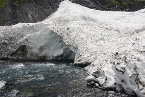
As the name implies, a subglacial stream is a stream that flows beneath a glacier.
2m
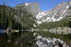
A tarn is a lake formed in a cirque (a cirque is bowl-shaped depression at the head of an alpine glacier).
2n
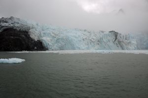
The terminus (or tow) of a glacier is the furthest/lower margin of a glacier - ie the "end" of the glacier.
3
4
There are several ways to classify glaciers, but in general, they can be divided into Continental and Alpine Glaciers.
Continental Glaciers are large glaciers that do not necessarily require mountains to form.
The main types of continental glaciers are Ice Sheets (covering more than 50,000 square kilometers, and currently including only the Greenland and Antarctic Ice Sheets) and Ice Caps, which are continental glaciers covering less than 50,000 square kilometers. A further extension of continental glaciers are Ice Shlfs - which are floating extensions of large glaciers into the water.
Alpine glaciers form in mountains, are much smaller than continental glaciers, and may in fact be part of larger continental glaciers. Four main categories of alpine glaciers are Cirque Glaciers (which form in bowl-like depressions in the mountains, and may feed other glacier types), Valley Glaciers (glaciers flowing through valleys), Piedmont Glaciers (Glaciers that flow out of valleys and canyons onto flatter lowlands), and Ice Fields, which may be larger conglomerations of glacial ice forming in the mountains and feeding several valley or piedmont glaciers.
5
5a
The area of a glacier where snowfall exceeds loss through melting or other processes
5b
The area of a glacier where loss of ice and snow exceeds accumulation.
5c
The area on a glacier between the Accumulation and Ablation zone, where the forces are equal.
6
7
In general, a valley formed by a river or stream is described as V shaped, whereas a glacial valley is U shaped.
8
9
9a
An Arête is the sharp, jagged peak that separates two glaciers or cirques.
9b
A Cirque is a bowl-shaped depression in alpine areas formed by a glacier.
9c
A Col is a low point or pass in an Arête or ridge that has been formed through erosion.
9d
A Drumlin is a tear or inverted half-canoe shaped ridge of debris shaped by a glacier. The pointed end points toward the glacier head, the flattened end is often steep.
9e
An Esker is a steep-sided meandering ridge formed by a subglacial or englacial stream and left behind by a retreating glacier.
9f
A Fjord is a U-shaped valley formed by a glacier that extends into the water below sea-level.
9g
A Glacial Horn forms when three or more Cirques intersect, shaping a pyramidal mountain peak (think of the Matterhorn).
9h
A Kame is a sand or gravel mound deposited by water flowing over a glacier.
9i
A Nunatak is a mountain peak that protrudes through a glacier, or through where two or more glaciers meet and converge.
9j
An Outwash Fan is an alluvial plain of graded debris laid down by glacial melt (think of it as a land-bound alluvial fan).
9k
Roche moutonnée is the term for an elongated, rounded knob of bedrock shaped by a moving glacier, gently slowing on the "upstream" side and steeper on the "downstream" side. (Compare to a drumlin, which is formed by glacial till, rather than carved out of the bedrock).
9l
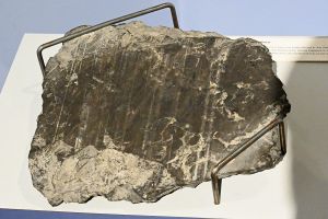
Striations refer to the lines and grooved carved into bedrock by a passing glacier. As the glacier moves, it also drags along rocks and other debris, and this scours the underlying rock, leaving the scratch marks.
9m
The Trim Line is the boundary on a glacial valley wall that shows the previous maximum width of the glacier.
10
Moraines are mounds of rock, sand, or other debris pushed up or deposited by a glacier. The main types of Moraines are:
Terminal Moraine, which forms at the terminus or maximum extent of a glacier
Lateral Moraine, which forms along the edge of a glacier from falling debris or eroded from the valley walls
Medial Moraine, which runs parallel to a glacier, but forms wheere two glaciers merge into a single flow
Recessional Moraine, which forms as smaller accumulations behind the terminal moraine, and marks shorter periods of eadvance and retreat
11
12
13
14
14a
14b
14c
14d
References
https://www.dnr.wa.gov/programs-and-services/geology/glaciers#
https://asf.alaska.edu/information/glacier-power/
https://nsidc.org/learn/parts-cryosphere/glaciers
https://mynasadata.larc.nasa.gov/stem-career-connections/science-glaciologist
https://www.antarcticglaciers.org/
https://www.nps.gov/subjects/aknatureandscience/glaciers.htm
https://www.nps.gov/subjects/geology/glacial-landforms.htm
http://www.geo.hunter.cuny.edu/~fbuon/GEOL_231/Lectures/Glacial%20Landforms.pdf
